Post-seismic Damage Assessment of infrastructures by using the DInSAR technique
 The main project objective was the testing and development of a Post-seismic Damage Assessment of buildings and infrastructures by using the satellite detection technologies, Differential SAR Interferometry (DInSAR) in order to support the civil protection activities.
This purpose has been pursued by the development of procedures for evaluating the damages to single buildings or built up area by:
– Interferometric techniques optimized for the assessment of permanent displacements of soil and structures;
– Engineering methods for the evaluation of damages from the Post Seismic – Permanent Residual Displacements (PS-PRD), as well
– GIS systems for the construction of damage scenarios.
The project foreseen the technologic development, testing as well as the application of interferometric measurements to study the damages to buildings caused by vibration effects of earthquakes and coseismic effects induced on the ground (landslides, liquefaction, subsidence, etc. ….).
In particular, we tried to identify a methodology for the quantification of disastrous effects of earthquakes immediately after the occurrence of the event (within 24-48 hours), both on a large territorial scale, considering as a reference the built up area and the key infrastructure works, and, in greater detail, the single structures of strategic importance (hospitals, fire brigade barracks, town halls, schools, etc..) for the civil protection purposes and post-event emergency management.
The definition of the post-seismic scenario requires long time, not compatible with the need to quickly and efficiently organize the rescue (immediate aid and emergency vehicles, dislocation of field hospitals, temporary accommodation, etc…), and also requires immediate, homogeneous and objective knowledge of the situation of the entire affected area, that can be acquired mainly by a dense network of tools appropriately placed on the singles buildings. This solution is totally prohibitive both for the high costs and the size of the managing and data processing system.
The essential and innovative element was the use of satellite interferometric data (DInSAR) for the determination of Post Seismic – Permanent Residual Displacements (PS-PRD), and the correlation of these displacements with the damages of the building. This was possible thanks to the preventive knowledge of the structural types and their expected behavior as a result of high earthquakes, so as to cause serious damage or collapse.
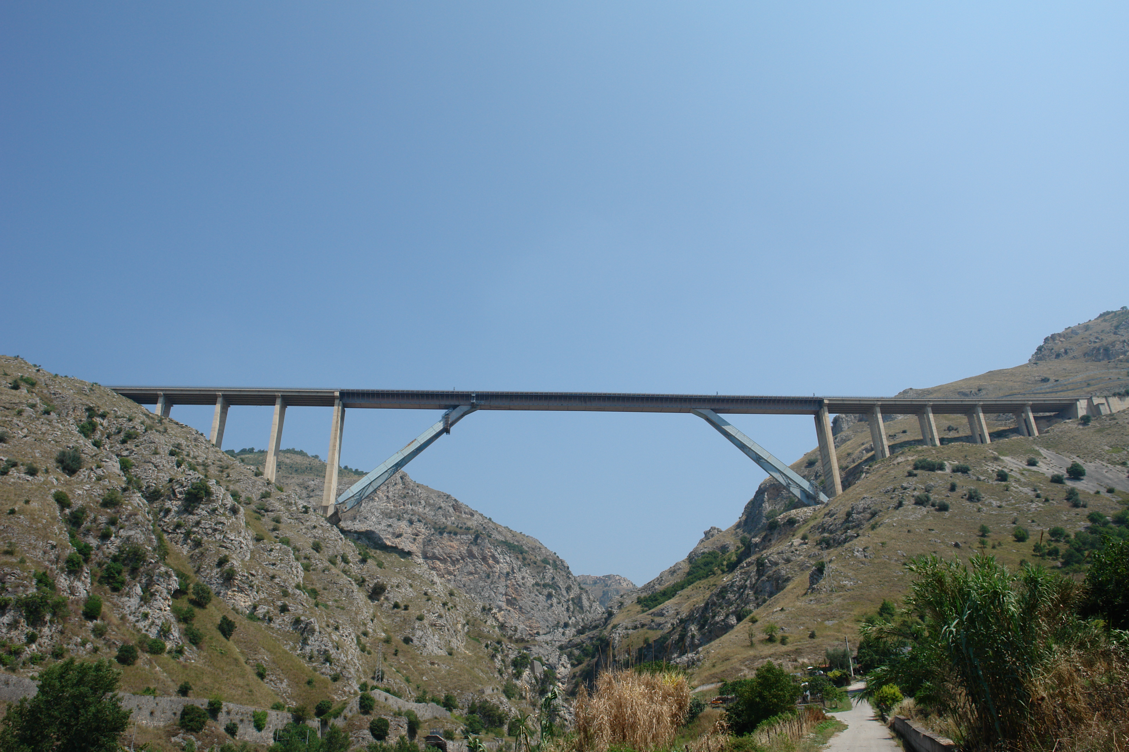
Regarding this issue, there were no specific studies as the seismic effects were essentially related to the maximum or integral values of some kinematic parameters (acceleration, speed, relative displacements, accumulated or dissipated energy), accessible only through an instrumentation disposed on the structures measuring the vibrations in particular points. This approach, even though feasible on single structures of particular importance, is absolutely impossible for a large number of structures, such as built up area or works of art of a transport infrastructure (regarding the last one, it is sufficient a serious damage to a single work so to put out of order the transmission for too long time).
On the other hand, it is evident that the damages, especially of a certain entity, are related to Post Seismic – Permanent Residual Displacements (PS-PRD).
This correlation has surely different features depending on the type of structure (buildings compared to bridges, reinforced concrete buildings compared to masonry buildings, masonry buildings current compared to churches in masonry, etc ….) so dedicated studies of numerical-experimental nature are necessary, also through the analysis of case studies and already available testing.
Organismo scientifico di diritto pubblico per lo sviluppo socio-economico e lo studio dei rischi naturali, fondato sotto l’egida dell’UNESCO e della Regione Basilicata
Via Domenico Di Giura, 54 (Centro Direzionale), 85100 Potenza, Italy - Tel/Fax: +39 0971 69511 - CF: 80011410760